
Co-founded with Chris Saad. The question that started the project: "how do I find the best driving roads in Australia?"
Data foundation
OpenStreetMap has nearly every road on Earth in one open dataset, distributed as binary extracts. That was the raw material. The trouble is that OSM is organised for cartographers. A road in OSM isn't "the Old Pacific Highway from A to B". It's a long run of short geometric ways, often split at every intersection, sometimes doubled up as two-way pairs, and edited by hundreds of mappers over a decade. The first job was turning that soup back into roads.
Approach
The reassembly was deliberately simple. Two ways with the same name whose endpoints sit close together are probably the same road, so we glued them together, and repeated that across the whole region. What came out was a clean list of named roads.
Scoring used two signals and ignored everything else:
- Windiness per kilometre: walk the coordinate list, add up the turning angle at every three points, and divide by the total length. A straight road scores almost nothing and a mountain road scores a lot.
- Surface: drop anything unpaved, gravel or dirt, and anything OSM tags as a poor surface.
We used no speed limits, traffic data or reviews, only geometry and surface, on the bet that the best driving roads would stand out on those two signals alone. When we tested it on a region where enthusiasts already had strong opinions, the results matched the roads they rated highest.
Product
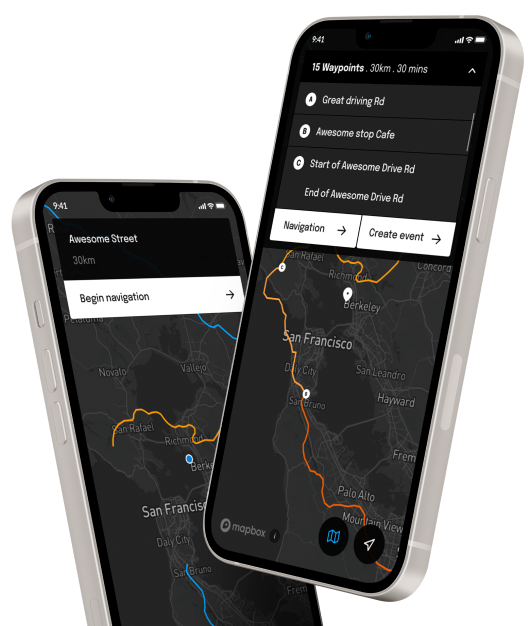
With the data working, we built the rest of Drive: the iOS app, route building, drive-day organising, convoy tracking and route sharing. The pipeline ended up covering more than 40 regions: Australia, most of Europe, North America and large parts of South America. Adding a region was a config entry, with no code change.

Engagement
Co-Founder and CTO. Built the road-extraction and scoring pipeline, the API serving the iOS app, the AWS infrastructure, and most of the early product. Active build wound down at the end of 2023.